"Behold, a tree in the midst of the earth, and the height thereof was great; the tree grew and was strong: and the height thereof reached unto heaven, and the sight thereof to the end of all the earth."—Dan. iy. 10, 11.
The limits of Babylonia Proper, the tract in which the dominant power of the Fourth Monarchy had its abode, being almost identical with those which have been already described under the head of Chaldaea, will not require in this place to be treated afresh, at any length. It needs only to remind the reader that Babylonia Proper is that alluvial tract towards the mouth of the two great rivers of Western Asia—the Tigris and the Euphrates—which intervenes between the Arabian Desert on the one side, and the more eastern of the two streams on the other. Across the Tigris the country is no longer Babylonia, but Cissia, or Susiana—a distinct region, known to the Jews as Elam—the habitat of a distinct people. Babylonia lies westward of the Tigris, and consists of two vast plains or flats, one situated between the two rivers, and thus forming the lower portion of the "Mesopotamia" of the Greeks and Romans—the other interposed between the Euphrates and Arabia, a long but narrow strip along the right bank of that abounding river. The former of these two districts is shaped like an ancient amphora, the mouth extending from Hit to Samarah, the neck lying between Baghdad and Ctesiphon on the Tigris, Mohammed and Mosaib on the Euphrates, the full expansion of the body occurring between Serut and El Khithr, and the pointed base reaching down to Kornah at the junction of the two streams. This tract, the main region of the ancient Babylonia, is about 320 miles long, and from 20 to 100 broad. It may be estimated to contain about 18,000 square miles. The tract west of the Euphrates is smaller than this. Its length, in the time of the Babylonian Empire, may be regarded as about 350 miles, its average width is from 25 to 30 miles, which would give an area of about 9000 square miles. Thus the Babylonia of Nabopolassar and Nebuchadnezzar may be regarded as covering a space of 27,000 square miles—a space a little exceeding the area of the Low countries.
The small province included within these limits—smaller than Scotland or Ireland, or Portugal or Bavaria—became suddenly, in the latter half of the seventh century B.C., the mistress of an extensive empire. On the fall of Assyria, about B.C. 625, or a little later, Media and Babylonia, as already observed, divided between them her extensive territory. It is with the acquisitions thus made that we have now to deal. We have to inquire what portion exactly of the previous dominions of Assyria fell to the lot of the adventurous Nabopolassar, when Nineveh ceased to be—what was the extent of the territory which was ruled from Babylon in the latter portion of the seventh and the earlier portion of the sixth century before our era?
Now the evidence which we possess on this point is threefold. It consists of certain notices in the Hebrew Scriptures, contemporary records of first-rate historical value; of an account which strangely mingles truth with fable in one of the books of the Apocrypha; and of a passage of Berosus preserved by Josephus in his work against Apion. The Scriptural notices are contained in Jeremiah, in Daniel, and in the books of Kings and Chronicles. From these sources we learn that the Babylonian Empire of this time embraced on the one hand the important country of Susiana or Elymais (Elam), while on the other it ran up the Euphrates at least as high as Carchemish, from thence extending westward to the Mediterranean, and southward to, or rather perhaps into, Egypt. The Apocryphal book of Judith enlarges these limits in every direction. That the Nabuchodonosor of that work is a reminiscence of the real Nebuchadnezzar there can be no doubt. The territories of that monarch are made to extend eastward, beyond Susiana, into Persia; northward to Nineveh; westward to Cilicia in Asia Minor; and southward to the very borders of Ethiopia. Among the countries under his sway are enumerated Elam, Persia, Assyria, Cilicia, Coele-Syria, Syria of Damascus, Phoenicia, Galilee, Gilead, Bashan, Judsea, Philistia, Goshen, and Egypt generally. The passage of Berosus is of a more partial character. It has no bearing on the general question of the extent of the Babylonian Empire, but, incidentally, it confirms the statements of our other authorities as to the influence of Babylon in the West. It tells us that Coele-Syria, Phoenicia, and Egypt, were subject to Nabopolassar, and that Nebuchadnezzar ruled, not only over these countries, but also over some portion of Arabia.
From these statements, which, on the whole, are tolerably accordant, we may gather that the great Babylonian Empire of the seventh century B.C. inherited from Assyria all the southern and western portion of her territory, while the more northern and eastern provinces fell to the share of Media. Setting aside the statement of the book of Judith (wholly unconfirmed as it is by any other authority), that Persia was at this time subject to Babylon, we may regard as the most eastern portion of the Empire the district of Susiana, which corresponded nearly with the modern Khuzistan and Luristan. This acquisition advanced the eastern frontier of the Empire from the Tigris to the Bakhtiyari Mountains, a distance of 100 or 120 miles. It gave to Babylon an extensive tract of very productive territory, and an excellent strategic boundary. Khuzistan is one of the most valuable provinces of modern Persia. It consists of a broad tract of fertile alluvium, intervening between the Tigris and the mountains, well watered by numerous large streams, which are capable of giving an abundant irrigation to the whole of the low region. Above this is Luristan, a still more pleasant district, composed of alternate mountain, valley, and upland plain, abounding in beautiful glens, richly wooded, and full of gushing brooks and clear rapid rivers. Much of this region is of course uncultivable mountain, range succeeding range, in six or eight parallel lines, as the traveller advances to the north-east; and most of the ranges exhibiting vast tracts of bare and often precipitous rock, in the clefts of which snow rests till midsummer. Still the lower flanks of the mountains are in general cultivable, while the valleys teem with orchards and gardens, and the plains furnish excellent pasture. The region closely resembles Zagros, of which it is a continuation. As we follow it, however, towards the south-east into the Bakhtiyari country, where it adjoins upon the ancient Persia, it deteriorates in character; the mountains becoming barer and more arid, and the valleys narrower and less fertile.
All the other acquisitions of Babylonia at this period lay towards the west. They consisted of the Euphrates valley, above Hit; of Mesopotamia Proper, or the country about the two streams of the Bilik and the Khabour; of Syria, Phoenicia, Palestine, Idumasa, Northern Arabia, and part of Egypt. The Euphrates valley from Hit to Balis is a tract of no great value, except as a line of communication. The Mesopotamian Desert presses it closely upon the one side, and the Arabian upon the other. The river flows mostly in a deep bed between cliffs of marl, gypsum, and limestone, or else between bare hills producing only a few dry sapless shrubs and a coarse grass; and there are but rare places where, except by great efforts, the water can be raised so as to irrigate, to any extent, the land along either bank. The course of the stream is fringed by date-palms as high as Anah, and above is dotted occasionally with willows, poplars, sumacs, and the unfruitful palm-tree. Cultivation is possible in places along both banks, and the undulating country on either side affords patches of good pasture. The land improves as we ascend. Above the junction of the Khabour with the main stream, the left bank is mostly cultivable. Much of the land is flat and well-wooded, while often there are broad stretches of open ground, well adapted for pasturage. A considerable population seems in ancient times to have peopled the valley, which did not depend wholly or even mainly on its own products, but was enriched by the important traffic which was always passing up and down the great river.
Mesopotamia Proper, or the tract extending from the head streams of the Khabour about Mardin and Nisibin to the Euphrates at Bir, and thence southwards to Karkesiyeh or Circesium, is not certainly known to have belonged to the kingdom of Babylon, but may be assigned to it on grounds of probability. Divided by a desert or by high mountains from the valley of the Tigris, and attached by means of its streams to that of the Euphrates, it almost necessarily falls to that power which holds the Euphrates under its dominion. The tract is one of considerable extent and importance. Bounded on the north by the range of hills which Strabo calls Mons Masius, and on the east by the waterless upland which lies directly west of the middle Tigris, it comprises within it all the numerous affluents of the Khabour and Bilik, and is thus better supplied with water than almost any country in these regions. The borders of the streams afford the richest pasture, and the whole tract along the flank of Masius is fairly fertile. Towards the west, the tract between the Khabour and the Bilik, which is diversified by the Abd-el-Aziz hills, is a land of fountains. "Such," says Ibn Haukal, "are not to be found elsewhere in all the land of the Moslems, for there are more than three hundred pure running brooks." Irrigation is quite possible in this region; and many remains of ancient watercourses show that large tracts, at some distance from the main streams, were formerly brought under cultivation.
Opposite to Mesopotamia Proper, on the west or right bank of the Euphrates, lay Northern Syria, with its important fortress of Carchemish, which was undoubtedly included in the Empire. This tract is not one of much value. Towards the north it is mountainous, consisting of spurs from Amanus and Taurus, which gradually subside into the desert a little to the south of Aleppo. The bare, round-backed, chalky or rocky ranges, which here continually succeed one another, are divided only by narrow tortuous valleys, which run chiefly towards the Euphrates or the lake of Antioch. This mountain tract is succeeded by a region of extensive plains, separated from each other by low hills, both equally desolate. The soil is shallow and stony; the streams are few and of little volume; irrigation is thus difficult, and, except where it can be applied, the crops are scanty. The pistachio-nut grows wild in places; Vines and olives are cultivated with some success; and some grain is raised by the inhabitants; but the country has few natural advantages, and it has always depended more upon its possession of a carrying trade than on its home products for prosperity.
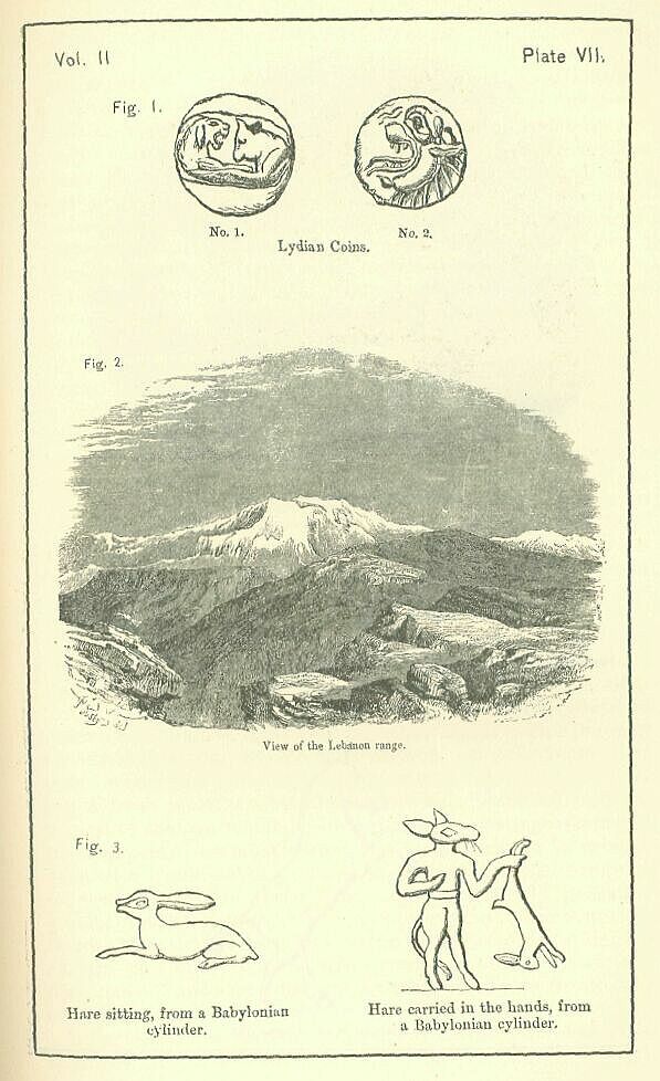
West and south-west of this region, between it and the Mediterranean, and extending southwards from Mount Amanus to the latitude of Tyre, lies Syria Proper, the Coele-Syria of many writers, a long but comparatively narrow tract of great fertility and value. Here two parallel ranges of mountains intervene between the coast and the desert, prolific parents of a numerous progeny of small streams. First, along the line of the coast, is the range known as Libanusin the south, from lat. 33� 20' to lat. 34� 40', and as Bargylus in the north, from lat. 34� 45' to the Orontes at Antioch, a range of great beauty, richly wooded in places, and abounding in deep glens, foaming brooks, and precipices of a fantastic form. [PLATE VII., Fig 2.] More inland is Antilibanus, culminating towards the south in Hermon, and prolonged northward in the Jebel Shashabu, Jebel Biha, and Jebel-el-Ala, which extends from near Hems to the latitude of Aleppo. More striking than even Lebanon at its lower extremity, where Hermon lifts a snowy peak into the air during most of the year, it is on the whole inferior in beauty to the coast range, being bleaker, more stony, and less broken up by dells and valleys towards the south, and tamer, barer, and less well supplied with streams in its more northern portion. Between the two parallel ranges lies the "Hollow Syria," a long and broadish valley, watered by the two streams of the Orontes and the "Litany" which, rising at no great distance from one another, flow in opposite directions, one hurrying northwards nearly to the flanks of Amanus, the other southwards to the hills of Galilee. Few places in the world are more, remarkable, or have a more stirring history, than this wonderful vale. Extending for above two hundred miles from north to south, almost in a direct line, and without further break than an occasional screen of low hills, it furnishes the most convenient line of passage between Asia and Africa, alike for the journeys of merchants and for the march of armies. Along this line passed Thothines and Barneses, Sargon, and Sennacherib, Neco and Nebuchadnezzar, Alexander and his warlike successors, Pompey, Antony, Kaled, Godfrey of Bouillon; along this must pass every great army which, starting from the general seats of power in Western Asia, seeks conquests in Africa, or which, proceeding from Africa, aims at the acquisition of an Asiatic dominion. Few richer tracts are to be found even in these most favored portions of the earth's surface. Towards the south the famous El-Bukaa is a land of cornfields and vineyards, watered by numerous small streams which fall into the Litany. Towards the north El-Ghab is even more splendidly fertile, with a dark rich soil, luxuriant vegetation, and water in the utmost abundance, though at present it is cultivated only in patches immediately about the towns, from fear of the Nusairiyeh and the Bedouins.
Parallel with the southern part of the Coele-Syrian valley, to the west and to the east, were two small but important tracts, usually regarded as distinct states. Westward, between the heights of Lebanon and the sea, and extending somewhat beyond Lebanon, both up and down the coast, was Phoenicia, a narrow strip of territory lying along the shore, in length from 150 to 180 miles, and in breadth varying from one mile to twenty. This tract consisted of a mere belt of sandy land along the sea, where the smiling palm-groves grew from which the country derived its name, of a broader upland region along the flank of the hills, which was cultivated in grain, and of the higher slopes of the mountains which furnished excellent timber. Small harbors, sheltered by rocky projections, were frequent along the coast. Wood cut in Lebanon was readily floated down the many streams to the shore, and then conveyed by sea to the ports. A narrow and scanty land made commerce almost a necessity. Here accordingly the first great maritime nation of antiquity grew up. The Phoenician fleets explored the Mediterranean at a time anterior to Homer, and conveyed to the Greeks and the other inhabitants of Europe, and of Northern and Western Africa, the wares of Assyria, Babylon, and Egypt. Industry and enterprise reaped their usual harvest of success; the Phoenicians grew in wealth, and their towns became great and magnificent cities. In the time when the Babylonian Empire came into being, the narrow tract of Phoenicia—smaller than many an English county—was among the most valuable countries of Asia; and its possession was far more to be coveted than that of many a land whose area was ten or twenty times as great.
Eastward of Antilibanus, in the tract between that range and the great Syrian desert, was another very important district—the district which the Jews called "Aram-Dammesek," and which now forms the chief part of the Pashalik of Damascus. From the eastern flanks of the Antilibanus two great and numerous smaller streams flow down into the Damascene plain, and, carrying with them that strange fertilizing power which water always has in hot climates, convert the arid sterility of the desert into a garden of the most wonderful beauty. The Barada and Awaaj, bursting by narrow gorges from the mountain chain, scatter themselves in numerous channels over the great flat, intermingling their waters, and spreading them out so widely that for a circle of thirty miles the deep verdure of Oriental vegetation replaces the red hue of the Hauran. Walnuts, planes, poplars, cypresses, apricots, orange-trees, citrons, pomegranates, olives, wave above; corn and grass of the most luxuriant growth, below. In the midst of this great mass of foliage the city of Damascus "strikes out the white arms of its streets hither and thither" among the trees, now hid among them, now overtopping them with its domes and minarets, the most beautiful of all those beautiful towns which delight the eye of the artist in the East. In the south-west towers the snow-clad peak of Hermon, visible from every part of the Damascene plain. West, north-west, and north, stretches the long Antilibanus range, bare, gray, and flat-topped, except where about midway in its course, the rounded summit of Jebel Tiniyen breaks the uniformity of the line. Outside the circle of deep verdure, known to the Orientals as El Merj ("the Meadow"), is a setting or framework of partially cultivable land, dotted with clumps of trees and groves, which extend for many miles over the plain. To the Damascus country must also be reckoned those many charming valleys of Hermon and Antilibanus which open out into it, sending their waters to increase its beauty and luxuriance, the most remarkable of which are the long ravine of the Barada, and the romantic Wady Halbon, whose vines produced the famous beverage which Damascus anciently supplied at once to the Tyrian merchant-princes and to the voluptuous Persian kings.
Below the Coelo-Syrian valley, towards the south, came Palestine, the Land of Lands to the Christian, the country which even the philosopher must acknowledge to have had a greater influence on the world's history than any other tract which can be brought under a single ethnic designation. Palestine—etymologically the country of the Philistines—was somewhat unfortunately named. Philistine influence may possibly have extended at a very remote period over the whole of it; but in historical times that warlike people did but possess a corner of the tract, less than one tenth of the whole—the low coast region from Jamnia to Gaza. Palestine contained, besides this, the regions of Galilee, Samaria, and Judaea, to the west of the Jordan, and those of Ituraea, Trachonitis, Bashan, and Gilead, east of that river. It was a tract 140 miles long, by from 70 to 100 broad, containing probably about 11,000 square miles. It was thus about equal in size to Belgium, while it was less than Holland or Hanover, and not much larger than the principality of Wales, with which it has been compared by a recent writer.
The great natural division of the country is the Jordan valley. This remarkable depression, commencing on the west flank of Hermon, runs with a course which is almost due south from lat. 33� 25' to lat. 31� 47', where it is merged in the Dead Sea, which may be viewed, however, as a continuation of the valley, prolonging it to lat. 31� 8'. This valley is quite unlike any other in the whole world. It is a volcanic rent in the earth's surface, a broad chasm which has gaped and never closed up. Naturally, it should terminate at Merom, where the level of the Mediterranean is nearly reached. By some wonderful convulsion, or at any rate by some unusual freak of Nature, there is a channel opened out from Merom, which rapidly sinks below the sea level, and allows the stream to flow hastily, down and still down, from Merom to Gennesareth, and from Gennesareth to the Dead Sea, where the depression reaches its lowest point, and the land, rising into a ridge, separates the Jordan valley from the upper end of the Gulf of Akabah. The Jordan valley divides Palestine, strongly and sharply, into two regions. Its depth, its inaccessibility (for it can only be entered from the highlands on either side down a few steep watercourses), and the difficulty of passing across it (for the Jordan has but few fords), give it a separating power almost equal to that of an arm of the sea. In length above a hundred miles, in width varying from one mile to ten, and averaging some five miles, or perhaps six, it must have been valuable as a territory, possessing, as it does, a rich soil, abundant water, and in its lower portion a tropical climate.
On either side of the deep Jordan cleft lies a highland of moderate elevation, on the right that of Galilee, Samaria, and Judsea, on the left that of Ituraea, Bashan, and Gilead. The right or western highland consists of a mass of undulating hills, with rounded tops, composed of coarse gray stone, covered, or scarcely covered, with a scanty soil, but capable of cultivation in corn, olives, and figs. This region is most productive towards the north, barer and more arid as we proceed southwards towards the desert. The lowest portion, Judaea, is unpicturesque, ill-watered, and almost treeless; the central, Samaria, has numerous springs, some rich plains, many wooded heights, and in places quite a sylvan appearance; the highest, Galilee, is a land of water-brooks, abounding in timber, fertile and beautiful. The average height of the whole district is from 1500 to 1800 feet above the Mediterranean. Main elevations within it vary from 2500 to 4000 feet. The axis of the range is towards the East, nearer, that is, to the Jordan valley than to the sea. It is a peculiarity of the highland that there is one important break in it. As the Lowland mountains of Scotland are wholly separated from the mountains of the Highlands by the low tract which stretches across from the Frith of Forth to the Frith of Clyde, or as the ranges of St. Gall and Appenzell are divided off from the rest of the Swiss mountains by the flat which extends from the Rhine at Eagatz to the same river at Waldshut, so the western highland of Palestine is broken in twain by the famous "plain of Esdraelon," which runs from the Bay of Acre to the Jordan valley at Beth-Shean or Scythopolis.
East of the Jordan no such depression occurs, the highland there being continuous. It differs from the western highland chiefly in this—that its surface, instead of being broken up into a confused mass of rounded hills, is a table-land, consisting of a long succession of slightly undulating plains. Except in Trachonitis and southern Ituraea, where the basaltic rock everywhere crops out, the soil is rich and productive, the country in places wooded with fine trees, and the herbage luxuriant. On the west the mountains rise almost precipitously from the Jordan valley, above which they tower to the height of 3000 or 4000 feet. The outline is singularly uniform; and the effect is that of a huge wall guarding Palestine on this side from the wild tribes of the desert. Eastward the tableland slopes gradually, and melts into the sands of Arabia. Here water and wood are scarce; but the soil is still good, and bears the most abundant crops.
Finally, Palestine contains the tract from which it derives its name, the low country of the Philistines, which the Jews called the Shephelah, together with a continuation of this tract northwards to the roots of Carmol, the district known to the Jews as "Sharon," or "the smooth place." From Carmol to the Wady Sheriah, where the Philistine country ended, is a distance of about one hundred miles, which gives the length of the region in question. Its breadth between the shore and the highland varies from about twenty-five miles, in the south, between Gaza and the hills of Dan, to three miles, or less, in the north, between Dor and the border of Manasseh. Its area is probably from 1400 to 1500 square miles, This low strip is along its whole course divided into two parallel belts or bands-the first a flat sandy tract along the shore, the Ramleh of the modern Arabs; the second, more undulating, a region of broad rolling plains rich in corn, and anciently clothed in part with thick woods, watered by reedy streams, which flow down from the great highland. A valuable tract is this entire plain, but greatly exposed to ravage. Even the sandy belt will grow fruit-trees; and the towns which stand on it, as Gaza, Jaffa, and Ashdod, are surrounded with huge groves of olives, sycamores, and palms, or buried in orchards and gardens, bright with pomegranates and orange-trees. The more inland region is of marvellous fertility. Its soil is a rich loam, containing scarcely a pebble, which yields year after year prodigious crops of grain—chiefly wheat—without manure or irrigation, or other cultivation than a light ploughing. Philistia was the granary of Syria, and was important doubly, first, as yielding inexhaustible supplies to its conqueror, and secondly as affording the readiest passage to the great armies which contended in these regions for the mastery of the Eastern World.
South of the region to which we have given the name of Palestine, intervening between it and Egypt, lay a tract, to which it is difficult to assign any political designation. Herodotus regarded it as a portion of Arabia, which he carried across the valley of the Arabah and made abut on the Mediterranean. To the Jews it was "the land of the south"—the special country of the Amalekites. By Strabo's time it had come to be known as Idumsea, or the Edomite country; and under this appellation it will perhaps be most convenient to describe it here. Idumasa, then, was the tract south and south-west of Palestine from about lat. 31� 10'. It reached westward to the borders of Egypt, which were at this time marked by the Wady-el-Arish, southward to the range of Sinai and the Elanitic Gulf, and eastward to the Great Desert. Its chief town was Petra, in the mountains east of the Arabah valley. The character of the tract is for the most part a hard gravelly and rocky desert; but occasionally there is good herbage, and soil that admits of cultivation; brilliant flowers and luxuriantly growing shrubs bedeck the glens and terraces of the Petra range; and most of the tract produces plants and bushes on which camels, goats, and even sheep will browse, while occasional palm groves furnish a grateful shade and an important fruit. The tract divides itself into four regions—first, a region of sand, low and flat, along the Mediterranean, the Shephelah without its fertility; next, a region of hard gravelly plain intersected by limestone ridges, and raised considerably above the sea level, the Desert of El-Tin, or of "the Wanderings;" then the long, broad, low valley of the Arabah, which rises gradually from the Dead Sea to an imperceptible watershed, and then falls gently to the head of the Gulf of Akabah, a region of hard sand thickly dotted with bushes, and intersected by numerous torrent courses; finally a long narrow region of mountains and hills parallel with the Arabah, constituting Idumsea Proper, or the original Edom, which, though rocky and rugged, is full of fertile glens, ornamented with trees and shrubs, and in places cultivated in terraces. In shape the tract was a rude square or oblong, with its sides nearly facing the four cardinal points, its length from the Mediterranean to the Gulf of Akabah being 130 miles, and its width from the Wady-el-Arish to the eastern side of the Petra mountains 120 miles. The area is thus about 1560 square miles.
Beyond the Wady-el-Arish was Egypt, stretching from the Mediterranean southwards a distance of nearly eight degrees, or more than 550 miles. As this country was not, however, so much a part of the Babylonian Empire as a dependency lying upon its borders, it will not be necessary to describe it in this place.
One region, however, remains still unnoticed which seems to have been an integral portion of the Empire. This is Palmyrene, or the Syrian Desert—the tract lying between Coelo-Syria on the one hand and the valley of the middle Euphrates on the other, and abutting towards the south on the great Arabian Desert, to which it is sometimes regarded as belonging. It is for the most part a hard sandy or gravelly plain, intersected by low rocky ranges, and either barren or productive only of some sapless shrubs and of a low thin grass. Occasionally, however, there are oases, where the fertility is considerable. Such an oasis is the region about Palmyra itself, which derived its name from the palm groves in the vicinity; here the soil is good, and a large tract is even now under cultivation. Another oasis is that of Karyatein, which is watered by an abundant stream, and is well wooded, and productive of grain. The Palmyrene, however, as a whole possesses but little value, except as a passage country. Though large armies can never have traversed the desert even in this upper region, where it is comparatively narrow, trade in ancient times found it expedient to avoid the long detour by the Orontes Valley, Aleppo, and Bambuk, and to proceed directly from Damascus by way of Palymra to Thapsaeus on the Euphrates. Small bands of light troops also occasionally took the same course; and the great saving of distance thus effected made it important to the Babylonians to possess an authority over the region in question.
Such, then, in its geographical extent, was the great Babylonian Empire. Reaching from Luristan on the one side to the borders of Egypt on the other, its direct length from east to west was nearly sixteen degrees, or about 980 miles, while its length for all practical purposes, owing to the interposition of the desert between its western and its eastern provinces, was perhaps not less than 1400 miles. Its width was very disproportionate to this. Between Zagros and the Arabian Desert, where the width was the greatest, it amounted to about 280 miles; between Amanus and Palmyra it was 250; between the Mons Masius and the middle Euphrates it may have been 200; in Syria and Idumsea it cannot have been more than 100 or 160. The entire area of the Empire was probably from 240,000 to 250,000 square miles—which is about the present size of Austria. Its shape may be compared roughly to a gnomon, with one longer and one shorter arm.
It added to the inconvenience of this long straggling form, which made a rapid concentration of the forces of the Empire impossible, that the capital, instead of occupying a central position, was placed somewhat low in the longer of the two arms of the gnomon, and was thus nearly 1000 miles removed from the frontier province of the west. Though in direct distance, as the crow flies, Babylon is not more than 450 miles from Damascus, or more than 520 from Jerusalem, yet the necessary detour by Aleppo is so great that it lengthens the distance, in the one case by 250, in the other by 380 miles. From so remote a centre it was impossible for the life-blood to circulate very vigorously to the extremities.
The Empire was on the whole fertile and well-watered. The two great streams of Western Asia—the Tigris and the Euphrates—which afforded an abundant supply of the invaluable fluid to the most important of the provinces, those of the south-east, have already been described at length; as have also the chief streams of the Mesopotamian district, the Belik and the Khabour. But as yet in this work no account has been given of a number of important rivers in the extreme east and the extreme west, on which the fertility, and so the prosperity, of the Empire very greatly depended. It is proposed in the present place to supply this deficiency.
The principle rivers of the extreme east were the Choaspes, or modern Kerkhah, the Pasitigris or Eulseus, now the Kuran, the Hedyphon or Hedypnus, now the Jerahi, and the Oroatis, at present the Tab or Hindyan. Of these, the Oroatis, which is the most eastern, belongs perhaps more to Persia than to Babylon; but its lower course probably fell within the Susianian territory. It rises in the mountains between Shiraz and Persepolis, about lat. 29� 45', long. 52� 35' E.; and flows towards the Persian Gulf with a course which is north-west to Failiyun, then nearly W. to Zehitun, after which it becomes somewhat south of west to Hindyan, and then S.W. by S. to the sea. The length of the stream, without counting lesser windings, is 200 miles; its width at Hindyan, sixteen miles above its mouth, is eighty yards, and to this distance it is navigable for boats of twenty tons burthen. At first its waters are pure and sweet, but they gradually become corrupted, and at Hindyan they are so brackish as not to be fit for use. The Jerahi rises from several sources in the Kuh Margun, a lofty and precipitous range, forming the continuation of the chain of Zagros. about long. 50� to 51�, and lat. 31� 30'. These head-streams have a general direction from N.E. to S.W. The principal of them is the Kurdistan river, which rises about fifty miles to the north-east of Babahan and flowing south-west to that point, then bends round to the north, and runs north-west nearly to the fort of Mungasht, where it resumes its original direction, and receiving from the north-east the Abi Zard, or "Yellow River"—a delightful stream of the coldest and purest water possible—becomes known as the Jerahi, and carries a large body of water as far as Fellahiyeh or Dorak. Near Dorak the waters of the Jerahi are drawn off into a number of canals, and the river is thus greatly diminished; but still the stream struggles on, and proceeds by a southerly course towards the Persian Gulf, which it enters near Gadi in long. 48� 52'. The course of the Jerahi, exclusively of the smaller windings, is about equal in length to that of the Tab or Hindyan. In volume, before its dispersion, it is considerably greater than that river. It has a breadth of about a hundred yards before it reaches Babahan, and is navigable for boats almost from its junction with the Abi Zard. Its size is, however, greatly reduced in its lower course, and travellers who skirt the coast regard the Tab as the more important river.
The Kuran is a river very much exceeding in size both the Tab and the Jerahi. It is formed by the junction of two large streams—the Dizful river and the Kuran proper, or river of Shuster. Of these the Shuster stream is the more eastern. It rises in the Zarduh Kuh, or "Yellow Mountain," in lat. 32�, long. 51�, almost opposite to the river Isfahan. From its source it is a large stream. Its direction is at first to the southeast, but after a while it sweeps round and runs considerably north of west; and this course it pursues through the mountains, receiving tributaries of importance from both sides, till, near Akhili, it turns round to the south, and, cutting at a right angle the outermost of the Zagros ranges, flows down with a course S.W. by S. nearly to Sinister, where, in consequence of a bund or dam thrown across it, it bifurcates, and passes in two streams to the right and to the left of the town. The right branch, which earned commonly about two thirds of the water, proceeds by a tortuous course of nearly forty miles, in a direction a very little west of south, to its junction with the Dizful stream, which takes place about two miles north of the little town of Bandi-kir. Just below that town the left branch, called at present Abi-Gargar, which has made a considerable bend to the east, rejoins the main stream, which thenceforth flows in a single channel. The course of the Kuran from its source to its junction with the Dizful branch, including main windings, is about 210 miles. The Dizful. branch rises from two sources, nearly a degree apart, in lat. 33� 30'. These streams run respectively south-east and south-west, a distance of forty miles, to their junction near Bahrein, whence their united waters flow in a tortuous course, with a general direction of south, for above a hundred miles to the outer barrier of Zagros, which they penetrate near the Diz fort, through a succession of chasms and gorges. The course of the stream from this point is south-west through the hills and across the plain, past Dizful, to the place where it receives the Beladrud from the west, when it changes and becomes first south and then southeast to its junction with the Shuster river near Bandi-kir. The entire course of the Dizful stream to this point is probably not less than 380 miles. Below Bandi-kir, the Kuran, now become "a noble river, exceeding in size the Tigris and Euphrates," meanders across the plain in a general direction of S.S. W., past the towns of Uris, Ahwaz, and Ismaili, to Sablah, when it turns more to the west, and passing Mohammerah, empties itself into the Shat-el-Arab, about 22 miles below Busra. The entire course of the Kuran from its most remote source, exclusive of the lesser windings, is not less than 430 miles.
The Kerkhah (anciently the Choaspes) is formed by three streams of almost equal magnitude, all of them rising in the most eastern portion of the Zagros range. The central of the three flows from the southern flank of Mount Elwand (Orontes), the mountain behind Hamadan (Ecbatana), and receives on the right, after a course of about thirty miles, the northern or Singur branch, and ten miles further on the southern or Guran branch, which is known by the name of the Gamas-ab. The river thus formed flows westward to Behistun, after which it bonds to the south-west, and then to the south, receiving tributaries on both hands, and winding among the mountains as far as the ruined city of Rudbar. Here it bursts through the outer barrier of the great range, and, receiving the large stream of the Kirrind from the north-west, flows S.S.E. and S.E. along the foot of the range, between it and the Kebir Kuh, till it meets the stream of the Abi-Zal, when it finally leaves the hills and flows through the plain, pursuing a S.S.E. direction to the ruins of Susa, which lie upon its left bank, and then turning to the S. S. W., and running in that direction to the Shat-el-Arab, which it reaches about five miles below Kurnur. Its length is estimated at above 500 miles; its width, at some distance above its junction with the Abi-Zal, is from eighty to a hundred yards.
The course of the Kerkhah was not always exactly such as is here described. Anciently it appears to have bifurcated at Pai Pul, 18 or 20 miles N.W. of Susa, and to have sent a branch east of the Susa ruins, which absorbed the Shapur, a small tributary of the Dizful stream, and ran into the Kuran a little above Ahwaz. The remains of the old channel are still to be traced; and its existence explains the confusion, observable in ancient times, between the Kerkhah and the Kuran, to each of which streams, in certain parts of their course, we find the name Eulseus applied. The proper Eulseus was the eastern branch of the Kerkhah (Choaspes) from Pai Pul to Ahwaz; but the name was naturally extended both northwards to the Choaspes above Pai Pul and southwards to the Kuran below Ahwaz. The latter stream was, however, known also, both in its upper and its lower course, as the Pasitigris.
On the opposite side of the Empire the rivers were less considerable. Among the most important may be mentioned the Sajur, a tributary of the Euphrates, the Koweik, or river of Aleppo, the Orontes, or river of Antioch, the Litany, or river of Tyre, the Barada, or river of Damascus, and the Jordan, with its tributaries, the Jabbok and the Hieromax.
The Sajur rises from two principle sources on the southern flanks of Amanus, which, after running a short distance, unite a little to the east of Ain-Tab. The course of the stream from the point of junction is south-east. In this direction it flows in a somewhat tortuous channel between two ranges of hills for a distance of about 30 miles to Tel Khalid, a remarkable conical hill crowned by ruins. Here it receives an important affluent—the Keraskat—from the west, and becomes suitable for boat navigation. At the same time its course changes, and runs eastward for about 12 miles; after which the stream again inclines to the south, and keeping an E.S.E. direction for 14 or 15 miles, enters the Euphrates by five mouths in about lat. 36� 37'. The course of the river measures probably about 65 miles.
The Koweik, or river of Aleppo (the Chalus of Xenophon), rises in the hills south of Ain-Tab. Springing from two sources, one of which is known as the Baloklu-Su, or "Fish River," it flows at first eastward, as if intending to join the Euphrates. On reaching the plain of Aleppo, however, near Sayyadok-Koi, it receives a tributary from the north, which gives its course a southern inclination; and from this point it proceeds in a south and south-westerly direction, winding along the shallow bed which it has scooped in the Aloppo plain, a distance of 60 miles, past Aleppo to Kinnisrin, near the foot of the Jebel-el-Sis. Here its further progress southward is barred, and it is forced to turn to the east along the foot of the mountain, which it skirts for eight or ten miles, finally entering the small lake or marsh of El Melak, in which it loses itself after a source of about 80 miles.
The Orontes, the great river of Assyria, rises in the Buka'a—the deep valley known to the ancients as Coele-Syria Proper—springing from a number of small brooks, which flow down from the Antilibanus range between lat. 34� 5' and lat. 34� 12'. Its most remote source is near Yunin, about seven mites N.N.E. of Baalbek. The stream flows at first N.W. by W. into the plain, on reaching which it turns at a right-angle to the northeast, and skirts the foot of the Antilibanus range as far as Lebweh, where, being joined by a larger stream from the southeast,130 it takes its direction and flows N.W. and then N. across the plain to the foot of Lebanon. Here it receives the waters of a much more abundant fountain, which wells out from the roots of that range, and is regarded by the Orientals as the true "head of the stream." Thus increased the river flows northwards for a short space, after which it turns to the northeast, and runs in a deep cleft along the base of Lebanon, pursuing this direction for 15 or 16 miles to a point beyond Ribleh, nearly in lat. 34� 30'. Here the course of the river again changes, becoming slightly west of north to the Lake of Hems (Buheiret-Hems), which is nine or ten miles below Ribleh. Issuing from the Lake of Hems about lat. 34� 43', the Orontes once more flows to the north east, and in five or six miles reaches Hems itself, which it leaves on its right bank. It then flows for twenty miles nearly due north, after which, on approaching Hama (Hamath), it makes a slight bend to the east round the foot of Jebel Erbayn, and then entering the rich pasture country of El-Ghab' runs north-west and north to the "Iron Bridge" (Jisr Hadid), in lat. 36� 11'. Its course thus far has been nearly parallel with the coast of the Mediterranean, and has lain between two ranges of mountains, the more western of which has shut it out from the sea. At Jisr Hadid the western mountains come to an end, and the Orontes, sweeping round their base, runs first west and then south-west down the broad valley of Antioch, in the midst of the most lovely scenery, to the coast, which it reaches a little above the 36th parallel, in long. 35� 55'. The course of the Orontes, exclusive of lesser windings, is about 200 miles. It is a considerable stream almost from its source. At Hamah, more than a hundred miles from its mouth, it is crossed by a bridge of thirteen arches. At Antioch it is fifty yards in width, and runs rapidly. The natives now call it the Nahr-el-Asy, or "Rebel River," either from its running in an opposite direction to all other streams of the country, or (more probably) from its violence and impetuosity.
There is one tributary of the Orontes which deserves a cursory mention. This is the Kara Su, or "Black River," which reaches it from the Aga Denghis, or Bahr-el-Abiyad, about five miles below Jisr Hadid and four or five above Antioch. This stream brings into the Orontes the greater part of the water that is drained from the southern side of Amanus. It is formed by a union of two rivers, the upper Kara Su and the Afrin, which flow into the Aga Denghis (White Sea), or Lake of Antioch, from the north-west, the one entering it at its northern, the other at its eastern extremity. Both are considerable streams; and the Kara Su on issuing from the lake carries a greater body of water than the Orontes itself, and thus adds largely to the volume of that stream in its lower course from the point of junction to the Mediterranean.
The Litany, or river of Tyre, rises from a source at no great distance from the head springs of the Orontes. The almost imperceptible watershed of the Buka'a runs between Yunin and Baalbek, a few miles north of the latter; and when it is once passed, the drainage of the water is southwards. The highest permanent fountain of the southern stream seems to be a small lake near Tel Hushben, which lies about six miles to the south-west of the Baalbek ruins. Springing from this source the Litany flows along the lower Buka'a in a direction which is generally a little west of south, receiving on either side a number of streamlets and rills from Libanus and Anti-libanus, and giving out in its turn numerous canals for irrigation, which fertilize the thirsty soil. As the stream descends with numerous windings, but still with the same general course, the valley of the Buka'a contracts more and more, till finally it terminates in a gorge, down which thunders the Litany—a gorge a thousand feet or more in depth, and so narrow that in one place it is actually bridged over by masses of rock which have fallen from the jagged sides. Narrower and deeper grows the gorge, and the river chafes and foams through it, gradually working itself round to the west, and so clearing a way through the very roots of Lebanon to the low coast tract, across which it meanders slowly, as if wearied with its long struggle, before finally emptying itself into the sea. The course of the Litany may be roughly estimated at from 70 to 75 miles.
The Barada, or river of Damascus, rises in the plain of Zebdany—the very centre of the Antilibanus. It has its real permanent source in a small nameless lake in the lower part of the plain, about lat. 33� 41'; but in winter it is fed by streams flowing from the valley above, especially by one which rises in lat. 33� 46', near the small hamlet of Ain Hawar. The course of the Barada from the small lake is at first towards the east; but it soon sweeps round and flows-southward for about four miles to the lower end of the plain, after which it again turns to the east and enters a romantic glen, running between high cliffs, and cutting through the main ridge of the Antilibanus between the Zebdany plain and Suk, the Abila of the ancients. From Suk the river flows through a narrow but lovely valley, in a course which has a general direction of south-east, past Ain Fijoh (where its waters are greatly increased), through a series of gorges and glens, to the point where the roots of the Antilibanus sink down upon the plain, when it bursts forth from the mountains and scatters. Channels are drawn from it on either side, and its waters are spread far and wide over the Merj, which it covers with fine trees and splendid herbage.
One branch passes right through the city, cutting it in half. Others irrigate the gardens and orchards both to the north and to the south. Beyond the town the tendency to division still continues. The river, weakened greatly through the irrigation, separates into three main channels, which flow with divergent courses towards the east, and terminate in two large swamps or lakes, the Bahret-esh-Shurkiyeh and the Bahret-el-Kibli-yeh, at a distance of sixteen or seventeen miles from the city. The Barada is a short stream, its entire course from the plain of Zebdany not much exceeding forty miles.
The Jordan is commonly regarded as flowing from two sources in the Huleh or plain immediately above Lake Merom, one at Banias (the ancient Paneas), the other at Tel-el-Kady, which marks the site of Laish or Dan. But the true highest present source of the river is the spring near Hasbeiya, called Nebaes-Hasbany, or Eas-en-Neba. This spring rises in the torrent-course known as the Wady-el-Teim, which descends from the north-western flank of Hermon, and runs nearly parallel with the great gorge of the Litany, having a direction from north-east to south-west. The water wells forth in abundance from the foot of a volcanic bluff, called Eas-el-Anjah, lying directly north of Hasbeiya, and is immediately used to turn a mill. The course of the streamlet is very slightly west of south down the Wady to the Huleh plain, where it is joined, and multiplied sevenfold, by the streams from Banais and Tel-el-Kady, becoming at once worthy of the name of river. Hence it runs almost due south to the Merom lake, which it enters in lat. 33� 7', through a reedy and marshy tract which it is difficult to penetrate. Issuing from Merom in lat. 33� 3', the Jordan flows at first sluggishly southward to "Jacob's Bridge," passing which, it proceeds in the same direction, with a much swifter current down the depressed and narrow cleft between Merom and Tiberias, descending at the rate of fifty feet in a mile, and becoming (as has been said) a sort of "continuous waterfall." Before reaching Tiberias its course bends slightly to the west of south for about two miles, and it pours itself into that "sea" in about lat. 32� 53'. Quitting the sea in lat. 32� 42', it finally enters the track called the Ghor, the still lower chasm or cleft which intervenes between Tiberias and the upper end of the Dead Sea. Here the descent of the stream becomes comparatively gentle, not much exceeding three feet per mile; for though the direct distance between the two lakes is less than seventy miles, and the entire fall above 600 feet, which would seem to give a descent of nine or ten feet a mile, yet, as the course of the river throughout this part of its career is tortuous in the extreme, the fall is really not greater than above indicated. Still it is sufficient to produce as many as twenty-seven rapids, or at the rate of one to every seven miles. In this part of its course the Jordan receives two important tributaries, each of which seems to deserve a few words.
The Jarmuk, or Sheriat-el-Mandhur, anciently the Hiero-max, drains the water, not only from Gaulonitis or Jaulan, the country immediately east and south-east of the sea of Tiberias, but also from almost the whole of the Hauran. At its mouth it is 130 feet wide, and in the winter it brings down a great body of water into the Jordan. In summer, however, it shrinks up into an inconsiderable brook, having no more remote sources than the perennial springs at Mazarib, Dilly, and one or two other places on the plateau of Jaulan. It runs through a fertile country, and has generally a deep course far below the surface of the plain; ere falling into the Jordan it makes its way through a wild ravine, between rugged cliffs of basalt, which are in places upwards of a hundred feet in height.
The Zurka, or Jabbok, is a stream of the same character with the Hieromax, but of inferior dimensions and importance. It drains a considerable portion of the land of Gilead, but has no very remote sources, and in summer only carries water through a few miles of its lower course. In winter, on the contrary, it is a roaring stream with a strong current, and sometimes cannot be forded. The ravine through which it flows is narrow, deep, and in some places wild. Throughout nearly its whole course it is fringed by thickets of cane and oleander, while above, its banks are clothed with forests of oak.
The Jordan receives the Hieromax about four or five miles below the point where it issues from the Sea of Tiberias, and the Jabbok about half-way between that lake and the Dead Sea. Augmented by these streams, and others of less importance from the mountains on either side, it becomes a river of considerable size, being opposite Beth-shan (Beisan) 140 feet wide, and three feet deep, and averaging, in its lower course, a width of ninety with a depth of eight or nine feet. Its entire course, from the fountain near Hasbeiya to the Dead Sea, including the passage of the two lakes through which it flows, is, if we exclude meanders, about 130, if we include them, 360 miles. It is calculated to pour into the Dead Sea 6,090,000 tons of water daily.
Besides these rivers the Babylonian territory comprised a number of important lakes. Of these some of the more eastern have been described in a former volume: as the Bahr-i-Nedjif in Lower Chaldsea, and the Lake of Khatouniyeh in the tract between the Sinjar and the Khabour. It was chiefly, however, towards the west that sheets of water abounded: the principal of these were the Sabakhah, the Bahr-el-Melak, and the Lake of Antioch in Upper Syria; the Bahr-el-Kades, or Lake of Hems, in the central region; and the Damascus lakes, the Lake of Merom, the Sea of Galilee or Tiberias, and the Dead Sea, in the regions lying furthest to the south. Of these the greater number were salt, and of little value, except as furnishing the salt of commerce; but four—the Lake of Antioch, the Bahr-el-Kades, the Lake Merom, and the Sea of Galilee-were fresh-water basins lying upon the courses of streams which ran through them; and these not only diversified the scenery by their clear bright aspect, but were of considerable value to the inhabitants, as furnishing them with many excellent sorts of fish.
Of the salt lakes the most eastern was the Sabakhah. This is a basin of long and narrow form, lying on and just below the 36th parallel. It is situated on the southern route from Balis to Aleppo, and is nearly equally distant between the two places. Its length is from twelve to thirteen miles; and its width, where it is broadest, is about five miles. It receives from the north the waters of the Nahr-el-Dhahab, or "Golden River" (which has by some been identified with the Daradax of Xenophon), and from the west two or three insignificant streams, which empty themselves into its western extremity. The lake produces a large quantity of salt, especially after wet seasons, which is collected and sold by the inhabitants of the surrounding country.
The Bahr-el-Molak, the lake which absorbs the Koweik, or river of Aleppo, is less than twenty miles distant from Lake Sabakhah, which it very much resembles in its general character. Its ordinary length is about nine miles, and its width three or four; but in winter it is greatly swollen by the rains, and at that time it spreads out so widely that its circumference sometimes exceeds fifty miles. Much salt is drawn from its bed in the dry season, and a large part of Syria is hence supplied with the commodity. The lake is covered with small islands, and greatly frequented by aquatic birds-geese, ducks, flamingoes, and the like.
The lakes in the neighborhood of Damascus are three in number, and are all of a very similar type. They are indeterminate in size and shape, changing with the wetness or dryness of the season; and it is possible that sometimes they may be all united in one. The most northern, which is called the Bahret-esh-Shurkiyeh, receives about half the surplus water of the Barada, together with some streamlets from the outlying ranges of Antilibanus towards the north. The central one, called the Bahret-el-Kibliyeh, receives the rest of the Barada water, which enters it by three or four branches on its northern and western sides. The most southern, known as Bahret-Hijaneh, is the receptacle for the stream of the Awaaj, and takes also the water from the northern parts of the Ledjah, or region of Argob. The three lakes are in the same line—a line which runs from N.N.E. to S.S.W. They are, or at least were recently, separated by tracts of dry land from two to four miles broad. Dense thickets of tall reeds surround them, and in summer almost cover their surface. Like the Bahr-el-Melak, they are a home for water-fowl, which flock to them in enormous numbers.
By far the largest and most important of the salt lakes is the Great Lake of the South—the Bahr Lut ("Sea of Lot"), or Dead Sea. This sheet of water, which has always attracted the special notice and observation of travellers, has of late years been scientifically surveyed by officers of the American navy; and its shape, its size, and even its depth, are thus known with accuracy. The Dead Sea is of an oblong form, and would be of a very regular contour, were it not for a remarkable projection from its eastern shore near its southern extremity. In this place, a long and low peninsula, shaped like a human foot, projects into the lake, filling up two thirds of its width, and thus dividing the expanse of water into two portions, which are connected by a long and somewhat narrow passage. The entire length of the sea, from north to south, is 46 miles: its greatest width, between its eastern and its western shores, is 101 miles. The whole area is estimated at 250 geographical square miles. Of this space 174 square miles belong to the northern portion of the lake (the true "Sea"), 29 to the narrow channel, and 46 to the southern portion, which has been called "the back-water," or "the lagoon."
The most remarkable difference between the two portions of the lake is the contrast they present as to depth. While the depth of the northern portion is from 600 feet, at a short distance from the mouth of the Jordan, to 800, 1000, 1200, and even 1300 feet, further down, the depth of the lagoon is nowhere more than 12 or 13 feet; and in places it is so shallow that it has been found possible, in some seasons, to ford the whole way across from one side to the other. The peculiarities of the Dead Sea, as compared with other lakes, are its depression below the sea-level, its buoyancy, and its extreme saltness. The degree of the depression is not yet certainly known; but there is reason to believe that it is at least as much at 1300 feet, whereas no other lake is known to be depressed more than 570 feet. The buoyancy and the saltness are not so wholly unparalleled. The waters of Lake Urumiyeh are probably as salt and as buoyant; those of Lake Elton in the steppe east of the Wolga, and of certain other Russian lakes, appear to be even salter. But with these few exceptions (if they are exceptions), the Dead Sea water must be pronounced to be the heaviest and saltest water known to us. More than one fourth of its weight is solid matter held in solution. Of this solid matter nearly one third is common salt, which is more than twice as much as is contained in the waters of the ocean.
Of the fresh-water lakes the largest and most important is the Sea of Tiberias. This sheet of water is of an oval shape, with an axis, like that of the Dead Sea, very nearly due north and south. Its greatest length is about thirteen and its greatest width about six miles. Its extreme depth, so far as has been ascertained, is 27 fathoms, or 165 feet. The Jordan flows into its upper end turbid and muddy, and issues forth at its southern extremity clear and pellucid. It receives also the waters of a considerable number of small streams and springs, some of which are warm and brackish; yet its own water is always sweet, cool, and transparent, and, having everywhere a shelving pebbly beach, has a bright sparkling appearance. The banks are lofty, and in general destitute of verdure. What exactly is the amount of depression below the level of the Mediterranean remains still, to some extent, uncertain; but it is probably not much less than 700 feet. Now, as formerly, the lake produces an abundance of fish, which are pronounced, by those who have partaken of them, to be "delicious."
Nine miles above the Sea of Tiberias, on the course of the same stream, is the far smaller basin known now as the Bahr-el Huleh, and anciently (perhaps) as Merom. This is a mountain tarn, varying in size as the season is wet or dry, but never apparently more than about seven miles long, by five or six broad. It is situated at the lower extremity of the plain called Huleh, and is almost entirely surrounded by flat marshy ground, thickly set with reeds and canes, which make the lake itself almost unapproachable. The depth of the Huleh is not known. It is a favorite resort of aquatic birds, and is said to contain an abundant supply of fish.
The Bahr-el-Kades, or Lake of Hems, lies on the course of the Orontes, about 139 miles N.N.E. of Merom, and nearly the same distance south of the Lake of Antioch. It is a small sheet of water, not more than six or eight miles long, and only two or three wide, running in the same direction with the course of the river, which here turns from north to north-east. According to Abulfeda and some other writers, it is mainly, if not wholly, artificial, owing its origin to a dam or embankment across the stream, which is from four to five hundred yards in length, and about twelve or fourteen feet high. In Abulfeda's time the construction of the embankment was ascribed to Alexander the Great, and the lake consequently was not regarded as having had any existence in Babylonian times; but traditions of this kind are little to be trusted, and it is quite possible that the work above mentioned, constructed apparently with a view to irrigation, may really belong to a very much earlier age.
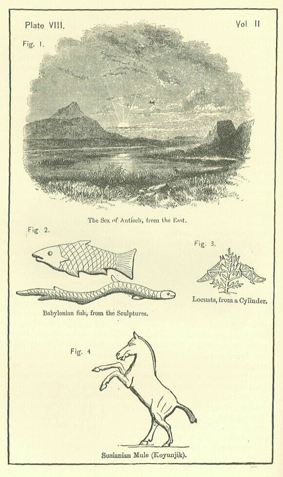
Finally, in Northern Syria, 115 miles north of the Bahr-el-Kades, and about 60 miles N.W.W. of the Bahr-el-Melak, is the Bahr-el-Abyad (White Lake), or Sea of Antioch. [PLATE. VIII., Fig. 1.] This sheet of water is a parallelogram, the angles of which face the cardinal points: in its greater diameter it extends somewhat more than ten miles, while it is about seven miles across. Its depth on the western side, where it approaches the mountains, is six or eight feet; but elsewhere it is generally more shallow, not exceeding three or four feet. It lies in a marshy plain called El-Umk, and is thickly fringed with reeds round the whole of its circumference. From the silence of antiquity, some writers have imagined that it did not exist in ancient times; but the observations of scientific travellers are opposed to this theory. The lake abounds with fish of several kinds, and the fishery attracts and employs a considerable number of the natives who dwell near it.
Besides these lakes, there were contained within the limits of the Empire a number of petty tarns, which do not merit particular description. Such were the Bahr-el-Taka, and other small lakes on the right bank of the middle Orontes, the Birket-el-Limum in the Lebanon, and the Birket-er-Eam on the southern flank of Hermon. It is unnecessary, however, to pursue this subject any further. But a few words must be added on the chief cities of the Empire, before this chapter is brought to a conclusion.
The cities of the Empire may be divided into those of the dominant country and those of the provinces. Those of the dominant country were, for the most part, identical with the towns already described as belonging to the ancient Chaldaea, Besides Babylon itself, there flourished in the Babylonian period the cities of Borsippa, Duraba, Sippara or Sepharvaim, Opis, Psittace, Cutha, Orchoe or Erech, and Diridotis or Teredon. The sites of most of those have been described in the first volume; but it remains to state briefly the positions of some few which were either new creations or comparatively undistinguished in the earlier times.
Opis, a town of sufficient magnitude to attract the attention of Herodotus, was situated on the left or east bank of the Tigris, near the point where the Diyaleh or Gyndes joined the main river. Its position was south of the Gyndes embouchure, and it might be reckoned as lying upon either river. The true name of the place—that which it bears in the cuneiform inscriptions—was Hupiya; and its site is probably marked by the ruins at Khafaji, near Baghdad, which place is thought to retain, in a corrupted form, the original appellation. Psittace or Sitace, the town which gave name to the province of Sittacene, was in the near neighborhood of Opis, lying on the same side of the Tigris, but lower down, at least as low as the modern fort of the Zobeid chief. Its exact site has not been as yet discovered. Teredon, or Diriaotis, appears to have been first founded by Nebuchadnezzar. It lay on the coast of the Persian Gulf, a little west of the mouth of the Euphrates, and protected by a quay, or a breakwater, from the high tides that rolled in from the Indian Ocean. There is great difficulty in identifying its site, owing to the extreme uncertainty as to the exact position of the coast-line, and the course of the river, in the time of Nebuchadnezzar. Probably it should be sought about Zobair, or a little further inland.. The chief provincial cities were Susa and Badaca in Susiana; Anat, Sirki, and Carchemish, on the Middle Euphrates; Sidikan on the Khabour; Harran on the Bilik; Hamath, Damascus, and Jerusalem, in Inner Syria; Tyre, Sidon, Ashdod, Ascalon, and Gaza, upon the coast. Of these, Susa was undoubtedly the most important; indeed, it deserves to be regarded as the second city of the Empire. Here, between the two arms of the Choaspes, on a noble and well-watered plain, backed at the distance of twenty-five miles by a lofty mountain range, the fresh breezes from which tempered the summer heats, was the ancient palace of the Kissian kings, proudly placed upon a lofty platform or mound, and commanding a wide prospect of the rich pastures at its base, which extended northwards to the roots of the hills, and in every other direction as far as the eye could reach. Clustered at the foot of the palace mound, more especially on its eastern side, lay the ancient town, the foundation of the traditional Memnon who led an army to the defence of Troy. The pure and sparkling water of the Choaspes—a drink fit for kings—flowed near, while around grew palms, konars, and lemon-trees, the plain beyond waving with green grass and golden corn. It may be suspected that the Babylonian kings, who certainly maintained a palace at this place, and sent high officers of their court to "do their business" there, made it their occasional residence, exchanging, in summer and early autumn, the heats and swamps of Babylon for the comparatively dry and cool region at the base of the Lurish hills. But, however, this may have been, at any rate Susa, long the capital of a kingdom little inferior to Babylon itself, must have been the first of the provincial cities, surpassing all the rest at once in size and in magnificence. Among the other cities, Carchemish on the Upper Euphrates, Tyre upon the Syrian coast, and Ashdod on the borders of Egypt, held the highest place. Carchemish, which has been wrongly identified with Circesium, lay certainly high up the river, and most likely occupied a site some distance to the north of Balis, which is in lat. 36� nearly. It was the key of Syria on the east, commanding the ordinary passage of the Euphrates, and being the only great city in this quarter. Tyre, which had by this time surpassed its rival, Sidon, was the chief of all the maritime towns; and its possession gave the mastery of the Eastern Mediterranean to the power which could acquire and maintain it. Ashdod was the key of Syria upon the south, being a place of great strength, and commanding the coast route between Palestine and Egypt, which was usually pursued by armies. It is scarcely too much to say that the possession of Ashdod, Tyre, and Carchemish, involved the lordship of Syria, which could not be permanently retained except by the occupation of those cities.
The countries by which the Babylonian Empire was bounded were Persia on the east, Media and her dependencies on the north, Arabia on the south, and Egypt at the extreme southwest. Directly to the west she had no neighbor, her territory being on that side washed by the Mediterranean.
Of Persia, which must be described at length in the next volume, since it was the seat of Empire during the Fifth Monarchy, no more need be said here than that it was for the most part a rugged and sterile country, apt to produce a brave and hardy race, but incapable of sustaining a large population. A strong barrier separated it from the great Mesopotamian lowland; and the Babylonians, by occupying a few easily defensible passes, could readily prevent a Persian army from debouching on their fertile plains. On the other hand, the natural strength of the region is so great that in the hands of brave and active men its defence is easy; and the Babylonians were not likely, if an aggressive spirit led to their pressing eastward, to make any serious impression in this quarter, or ever greatly to advance their frontier.
To Media, the power which bordered her upon the north, Babylonia, on the contrary, lay wholly open. The Medes, possessing Assyria and Armenia, with the Upper Tigris valley, and probably the Mons Masius, could at any time, with the greatest ease, have marched armies into the low country, and resumed the contest in which Assyria was engaged for so many hundred years with the great people of the south. On this side nature had set no obstacles; and, if danger threatened, resistance had to be made by means of those artificial works which are specially suited for flat countries. Long lines of wall, broad dykes, huge reservoirs, by means of which large tracts may be laid under water, form the natural resort in such a case; and to such defences as these alone, in addition to her armies, could Babylonia look in case of a quarrel with the Medes. On this side, however, she for many years felt no fear. Political arrangements and family ties connected her with the Median reigning house, and she looked to her northern neighbor as an ally upon whom she might depend for aid, rather than as a rival whose ambitious designs were to be watched and baffled.
Babylonia lay open also on the side of Arabia. Here, however, the nature of the country is such that population must be always sparse; and the habits of the people are opposed to that political union which can alone make a race really formidable to others. Once only in their history, under the excitement of a religious frenzy, have the Arabs issued forth from the great peninsula on an errand of conquest. In general they are content to vex and harass without seriously alarming their neighbors. The vast space and arid character of the peninsula are adverse to the collection and the movement of armies; the love of independence cherished by the several tribes indisposes them to union; the affection for the nomadic life, which is strongly felt, disinclines them to the occupation of conquests. Arabia, as a a conterminous power, is troublesome, but rarely dangerous: one section of the nation may almost always be played off against another: if "their hand is against every man," "every man's hand" is also "against them;" blood-feuds divide and decimate their tribes, which are ever turning their swords against each other; their neighbors generally wish them ill, and will fall upon them, if they can take them at a disadvantage; it is only under very peculiar circumstances, such as can very rarely exist, that they are likely even to attempt anything more serious than a plundering inroad. Babylonia consequently, though open to attack on the side of the south as well as on that of the north, had little to fear from either quarter. The friendliness of her northern neighbor, and the practical weakness of her southern one, were equal securities against aggression; and thus on her two largest and most exposed frontiers the Empire dreaded no attack.
But it was otherwise in the far south-west. Here the Empire bordered upon Egypt, a rich and populous country, which at all times covets Syria, and is often strong enough to seize and hold it in possession. The natural frontier is moreover weak, no other barrier separating between Africa and Asia than a narrow desert, which has never yet proved a serious obstacle to an army. From the side of Egypt, if from no other quarter, Babylonia might expect to have trouble. Here she inherited from her predecessor, Assyria, an old hereditary feud, which might at any time break out into active hostility. Here was an ancient, powerful, and well-organized kingdom upon her borders, with claims upon that portion of her territory which it was most difficult for her to defend effectively. By seas and by land equally the strip of Syrian coast lay open to the arms of Egypt, who was free to choose her time, and pour her hosts into the country when the attention of Babylon was directed to some other quarter. The physical and political circumstances alike pointed to hostile transactions between Babylon and her south-western neighbor. Whether destruction would come from this quarter, or from some other, it would have been impossible to predict. Perhaps, on the whole, it may be said that Babylon might have been expected to contend successfully with Egypt—that she had little to fear from Arabia—that against Persia Proper it might have been anticipated that she would be able to defend herself—but that she lay at the mercy of Media. The Babylonian Empire was in truth an empire upon sufferance. From the time of its establishment with the consent of the Medes, the Modes might at any time have destroyed it. The dynastic tie alone prevented this result. When that tie was snapped, and when moreover, by the victories of Cyrus, Persian enterprise succeeded to the direction of Median power, the fate of Babylon was sealed. It was impossible for the long straggling Empire of the south, lying chiefly in low, flat, open regions, to resist for any considerable time the great kingdom of the north, of the high plateau, and of the mountain-chains.