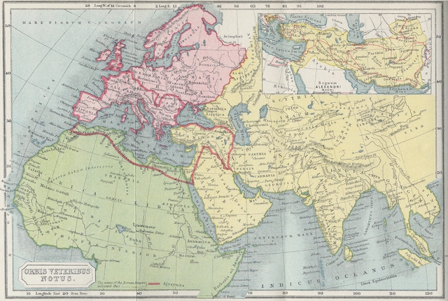
Map of the Roman Empire at its Greatest Extent (around 117 AD), Showing its Location on a Modern Map of the World
The Roman Empire was a colossus, and would rank even today as one of the largest countries in the world. At its greatest extent, the Roman Empire governed all of Western Europe, North Africa and the Middle East. All of the modern countries of France, Italy, Spain, Turkey, Syria and many more fit within its borders with ample room to spare.
Roman roads connected cities and towns to the capital and allowed trader and military units to move freely. At the core of the Empire was the Mediterranean, which the Romans called Mare Nostrum, Our Sea. For centuries, Roman galleys sailed the inland waters of the Mare Nostrum, forming ocean trade routes. Some intrepid trading fleets journeyed down the Red Sea to India and even China, bringing back spices and exotic goods from the East. It is possible that Roman galleys even reached the new world. It was an Empire which surpassed all other empires, and the standard against which later empires have measured themselves.
This section offers a wide range of maps of the ancient Roman Empire, showing its roads and cities as they existed during the height of Roman power, including maps of the core areas of the Empire: Italy, Gaul, Spain, and Greece. Each map is available in larger sizes to show details such as roads and villages.
Roman citizens lived in diverse regions, from the hot deserts of Egypt to the northern reaches of Britain. Yet, despite these regional differences, and mixture of races and religions, the Empire was a geographic whole, governed from Rome and Byzantium by an efficient civil service and communications network. These maps show the Roman world as it was experience by the people who lived in it.
It must be remembered, however, that these are relatively modern maps constructed using archaeological and archival sources. The Romans themselves did not make maps to the same level of precision as we did, since they lacked the use of latitude and longitude to properly determine the coordinates of each place. However the Romans did excel at measuring the distance between places by road. Each Roman road had roadside markers showing the distance in Roman miles from the closest important place so that travelers could tell where they were and how far they still had to go.
Map of the Roman Empire at its Greatest Extent (around 117 AD), Showing its Location on a Modern Map of the World
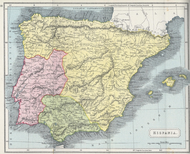
Map of Hispania, Modern Day Spain and Portugal During Roman Empire
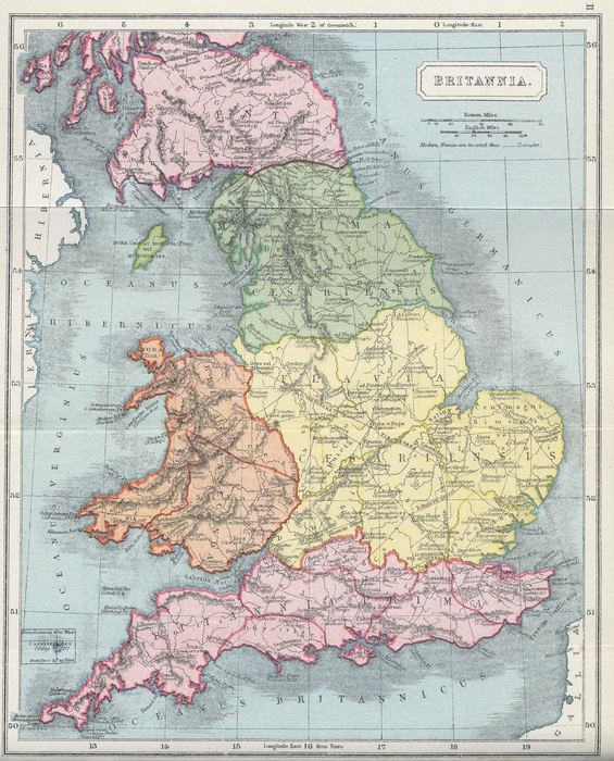
Map of Roman Britain
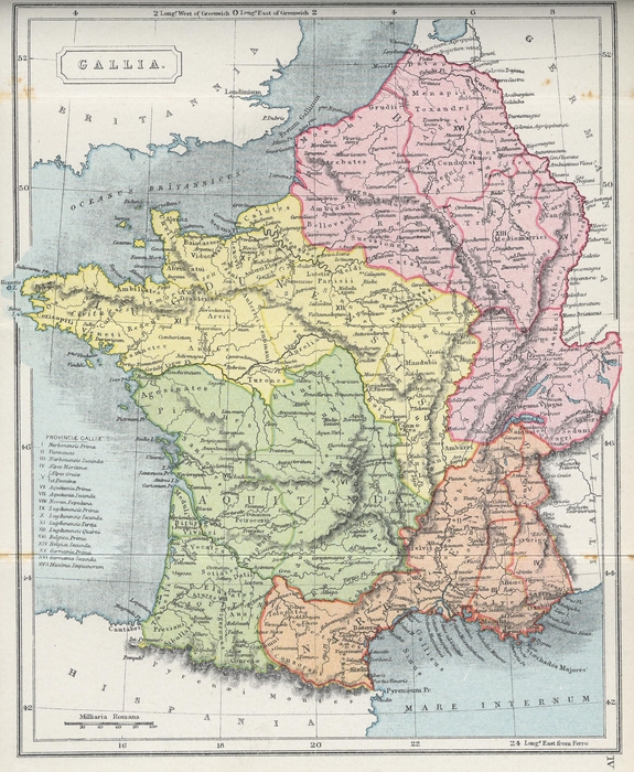
Map of Gaul (modern day France and Belgium)